Spatial data analysis
Spatial data analysis is a branch of data analysis that focuses on examining and interpreting data that has a spatial or geographic component. It involves studying the patterns, relationships, and characteristics of data within a spatial context. Spatial data refers to any information that is associated with specific geographic locations or areas, such as coordinates, addresses, or boundaries.
Understanding Spatial Data
Spatial data refers to information that pertains to specific geographic locations or areas. It encompasses a wide array of data types, including coordinates, addresses, boundaries, and even satellite imagery. The fundamental characteristic of spatial data is its inherent connection to a location, allowing analysts to examine data within the context of its geographical setting.
Methods
Spatial data analysis employs a diverse set of techniques and methods to explore and interpret geographical patterns. These approaches help to extract meaningful insights from spatial data and enable evidence-based decision-making. Let’s delve into some of the key techniques used in spatial data analysis:
- Spatial Descriptive Statistics: Spatial descriptive statistics provide a foundation for understanding the characteristics and patterns of spatial data. Statistical measures such as mean, median, standard deviation, and spatial distribution patterns like clustering, dispersion, and autocorrelation help identify trends, hotspots, and anomalies within spatial datasets.
- Spatial Interpolation: Spatial interpolation techniques facilitate the estimation of values at unobserved locations based on known values at nearby locations. Interpolation methods such as kriging, inverse distance weighting, and spline interpolation are commonly used to create continuous surfaces from discrete point data, aiding in mapping and visualizing spatial phenomena.
- Spatial Clustering and Hotspot Analysis: Clustering methods group spatial entities based on their proximity or similarity, enabling the identification of spatial clusters. Hotspot analysis identifies statistically significant areas with high or low concentrations of specific attributes or events. These techniques are valuable for detecting crime patterns, disease outbreaks, or identifying areas of high economic activity.
- Spatial Regression and Geostatistics: Spatial regression techniques integrate spatial relationships into traditional regression analysis, allowing for the modeling and prediction of spatial patterns. Geostatistics, on the other hand, models the spatial dependence and variability in data, enabling the exploration of phenomena such as soil contamination or air pollution and their spatial distribution.
- Spatial Data Visualization: Spatial data visualization plays a crucial role in conveying insights from spatial analysis. By leveraging maps, charts, graphs, and interactive visualizations, analysts can effectively communicate spatial relationships, patterns, and trends. Visualization aids in identifying spatial clusters, discerning spatial relationships between variables, and facilitating intuitive exploration and interpretation of complex spatial datasets.
Applications of Spatial Data Analysis
Spatial data analysis finds applications in a wide range of disciplines and industries. Here are a few examples:
- Urban Planning: Spatial analysis aids in optimizing urban infrastructure, identifying suitable locations for amenities, analyzing traffic patterns, and predicting future development scenarios.
- Environmental Studies: By analyzing spatial data, researchers can study the impact of environmental factors on ecosystems, model habitat suitability, track deforestation, and assess the effectiveness of conservation efforts.
- Epidemiology: Spatial data analysis plays a critical role in tracking disease outbreaks, identifying high-risk areas, understanding the spread of infectious diseases, and evaluating healthcare resource allocation.
- Natural Resource Management: Spatial analysis helps in assessing resource availability, monitoring land use changes, predicting crop yields, and optimizing resource extraction operations.
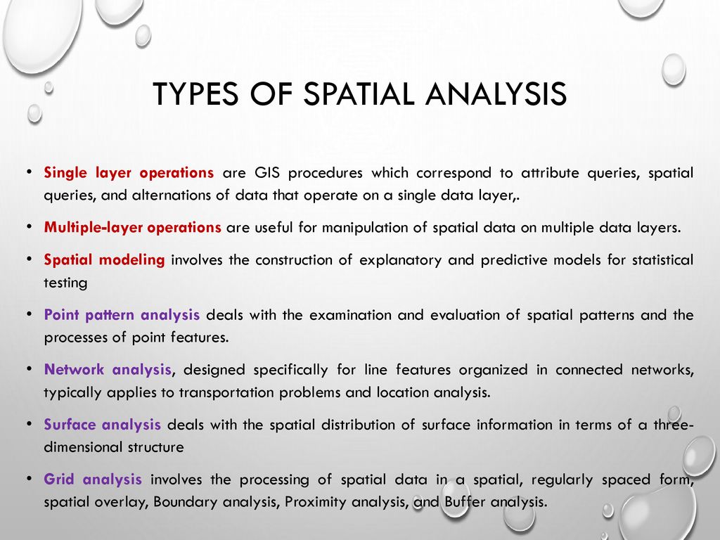
Type of Spatial data analysis

Spatial Descriptive Analysis: This type of analysis involves summarizing and describing spatial data using statistical measures and visualizations. It includes calculating basic statistics (e.g., mean, median, standard deviation) for spatial attributes, exploring spatial distribution patterns (e.g., clustering, dispersion), and generating thematic maps.
Spatial Interpolation: Interpolation techniques are used to estimate values at unobserved locations based on known values at nearby locations. These methods help create continuous surfaces or maps from discrete point data. Popular interpolation methods include kriging, inverse distance weighting, and spline interpolation.
Spatial Clustering: Clustering analysis aims to identify groups or clusters of similar spatial entities based on their proximity or similarity in attribute values. It helps uncover patterns and spatial structures within datasets. Cluster analysis methods include hierarchical clustering, k-means clustering, and DBSCAN (Density-Based Spatial Clustering of Applications with Noise).
Hotspot Analysis: Hotspot analysis identifies areas with statistically significant high or low concentrations of specific attributes or events. It helps detect spatial clusters or outliers. Common techniques for hotspot analysis include the Getis-Ord Gi* statistic, Anselin Local Moran’s I, and the kernel density estimation method.
Spatial Regression: Spatial regression models explore relationships between spatial data and other variables. They account for spatial dependencies and spatial autocorrelation. Spatial regression techniques include spatial autoregressive models (e.g., SAR, CAR), spatial error models, and geographically weighted regression (GWR).
Geostatistics: Geostatistics is a specialized field of spatial analysis that focuses on modeling and analyzing spatial dependence and variability in data. It incorporates techniques such as variogram analysis, kriging, and co-kriging to estimate values and uncertainties at unsampled locations.
Network Analysis: Network analysis involves studying spatial networks, such as transportation networks or social networks. It includes analyzing connectivity, shortest paths, network centrality, and flow analysis. Graph theory-based algorithms, such as Dijkstra’s algorithm and centrality measures, are commonly used in network analysis.
Spatial Data Mining: Spatial data mining combines spatial analysis techniques with data mining methods to extract knowledge and patterns from large spatial datasets. It involves techniques such as spatial association rule mining, spatial clustering, and spatial outlier detection.
Spatial Simulation: Spatial simulation models are used to simulate and predict spatial phenomena and their dynamics over time. Agent-based modeling, cellular automata, and Monte Carlo simulation are examples of spatial simulation techniques.
Uses of Spatial data analysis
Urban Planning and Development: Spatial data analysis helps urban planners and policymakers optimize land use, infrastructure development, and transportation networks. It aids in identifying suitable locations for residential, commercial, and recreational areas, analyzing traffic patterns, and predicting future growth scenarios.
Environmental Management: Spatial analysis is crucial for understanding and managing the environment. It assists in assessing the impact of human activities on natural resources, modeling habitats, and species distributions, monitoring land use changes, identifying areas prone to natural disasters, and planning conservation efforts.
Epidemiology and Public Health: Spatial data analysis plays a significant role in disease surveillance, outbreak investigation, and public health planning. It helps identify disease clusters, assess the spread of infectious diseases, analyze healthcare resource allocation, and study the impact of environmental factors on public health outcomes.
Natural Resource Management: Spatial analysis aids in managing and optimizing the use of natural resources such as forests, water, and minerals. It assists in assessing resource availability and quality, predicting crop yields, monitoring land degradation, planning sustainable forestry practices, and locating optimal sites for renewable energy installations.
Transportation and Logistics: Spatial analysis is utilized in transportation planning, logistics optimization, and route planning. It helps identify traffic congestion hotspots, analyze transportation networks’ efficiency, optimize delivery routes, and assess the accessibility and connectivity of transportation infrastructure.
Market Analysis and Retail Planning: Spatial data analysis supports businesses in understanding customer behavior, market trends, and location-based marketing. It aids in site selection for retail stores, analyzing trade areas, optimizing distribution networks, and identifying potential customer segments.
Emergency Response and Disaster Management: Spatial analysis assists in emergency response planning, disaster preparedness, and post-disaster recovery. It helps identify high-risk areas, plans evacuation routes, allocate emergency resources, assess damage extent, and prioritize recovery efforts.
Ecology and Conservation Biology: Spatial data analysis is critical for studying ecosystems, biodiversity, and conservation planning. It aids in mapping habitats, analyzing species distributions, identifying biodiversity hotspots, assessing ecological connectivity, and prioritizing conservation areas.
Agriculture and Precision Farming: Spatial analysis helps optimize agricultural practices by analyzing soil characteristics, monitoring crop health, and managing irrigation. It aids in precision farming techniques such as variable rate application of fertilizers and pesticides, optimizing planting patterns, and predicting crop yields.
Crime Analysis and Public Safety: Spatial data analysis is utilized in crime mapping, hotspot identification, and predictive policing. It helps identify crime patterns, allocate police resources effectively, and analyze the spatial relationships between crime incidents and social factors.


[…] Spatial data analysis […]
[…] Read Also..Spatial data analysis […]